
Introduction:
Understanding your property’s FEMA flood zone is crucial for risk management, financial protection, and responsible property ownership. This FEMA Flood Zone Guide will help you make informed decisions, take appropriate measures, and contribute to a safer and more resilient community. County-based CAD maps are valuable free resources that benefit professionals, businesses, emergency services, researchers, and the public. These maps provide detailed spatial information for informed decision-making, sustainable development, and improved public services within the county.
Step 1: Understanding FEMA Flood Zone Maps
FEMA flood zone maps, produced by the Federal Emergency Management Agency (FEMA) in the United States, are geographical representations that show areas at risk of flooding. These maps tell you the likelihood and severity of flooding events in specific regions.
The maps are typically color-coded and use different symbols to categorize areas based on their flood risk. The flood zones are classified into several categories, each representing a different level of flood hazard. Some of the commonly used flood zone designations include:
- Zone X (Minimal Risk): Areas in Zone X are considered to have minimal flood risk. These are areas where the probability of flooding is relatively low, usually less than 0.2% chance of annual flooding.
- Zone A and AE (High Risk): These are high-risk flood zones, typically located near rivers, lakes, and other bodies of water. The “A” zone is used for areas without detailed flood studies, while the “AE” zone incorporates detailed analysis and provides Base Flood Elevation (BFE) data.
- Zone V and VE (Coastal High Risk): These zones are specific to coastal areas and represent high-risk areas subject to wave action. Zone V is for areas with wave velocities, while VE incorporates BFE data.
- Zone B, C, and X500 (Moderate Risk): These are areas at moderate risk of flooding, located outside the high-risk zones but still susceptible to occasional flooding. These are less common to see. The most common designations are Zones X and A / AE.
Step 2: Locating Free County-based CAD Maps
To locate free county-based CAD maps, start by visiting the county government websites and exploring their Mapping section for GIS and CAD data. Additionally, check out dedicated GIS web portals, contact the county’s GIS departments directly, or search for state or regional GIS clearinghouses that provide CAD maps from multiple counties. Online repositories like Data.gov and OpenStreetMap offer extensive GIS data, including CAD maps. Local libraries, universities, and community forums may also have access to county-based CAD maps. Be sure to check for licensing and usage restrictions before using the data for commercial or critical purposes.
Step 3: Locating your Property ID
One essential piece of information you’ll need to find your property is the Property ID (also known as Parcel ID or Tax ID). This serves as a unique identifier and reference number for property taxation and various county records. Property IDs can vary significantly from county to county and state to state. The format and length of the ID can differ, making it important to familiarize yourself with the specific structure used in your area. In some places, the Property ID may consist of a combination of letters and numbers, while in others, it might be purely numeric.
Here are the ways to check your property ID:
Access the County Assessor’s Website:
- Go to the official website of the county assessor where your property is located. Typically, each county maintains a public database of property records, including property IDs.
Check your Warranty Deed:
- The Property ID is conveniently listed on the first page of the deed document, providing easy access for property identification.

Refer to your Property Tax Bill:
- Your Property ID is usually located on the upper right corner of the tax statement. This allows you to cross-reference the information with your property deed and other records, ensuring accuracy and clarity in property identification and taxation procedures.

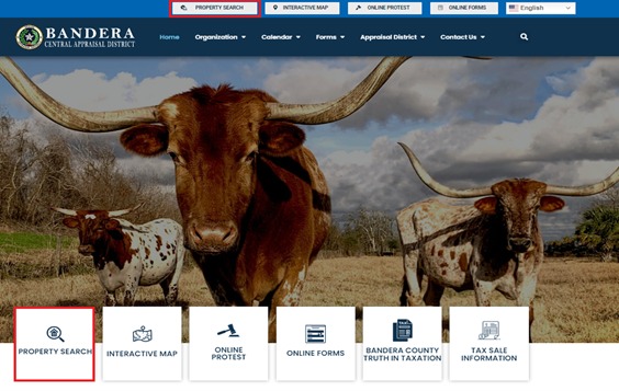
Step 4: Searching for your Property on the GIS Webpage
- To use the Property Search feature on the County GIS webpage, start by opening the webpage and locating the search bar. Enter either your property address or the owner’s name into the search bar and then click on the search button.

- The search results will show a list of properties that match your query, along with their corresponding Property IDs. This information will help you identify and locate your property within the county’s GIS system. Once you have identified your property ID matching your name and address, click on the row showing your parcel ID to view the property details.

- On the property details page, you’ll find comprehensive information about your property, including, but not limited to, your parcel ID, property address, land type, zoning, value, property tax, and an overview map. Additionally, there is a button available that will direct you to the GIS portal for further exploration and access to more geographic data.

FEMA Flood Zone Guide Step 5: Locating your property using GIS Interactive Map
- To access your county’s interactive map, utilize the search engine in your web browser, such as Google or Bing. Simply enter the name of your county, along with relevant keywords like “GIS map,” “interactive map,” or “property map.” Moreover, if you’ve previously used the CAD property search portal, you might discover a convenient button that provides a direct link to the GIS map. After agreeing to the disclaimer, the map will automatically zoom in on your property’s location, providing you with detailed information.

- Use the search function or navigation tools provided within the CAD maps to find and zoom in on your property. You can search for your property using different criteria, such as entering your property ID, address, or the name of the property owner. Once located, the map will allow you to explore and analyze your property’s details and surrounding area.

- Using the CAD map’s features, you can identify the boundaries of your property. The boundaries are the lines that mark the edges of your land, indicating the extent of your property ownership.

FEMA Flood Zone Guide Step 6: Compare the CAD Map with FEMA Flood Maps
With your parcel ID and property boundaries, you can cross-reference this information with FEMA flood maps. These maps show areas at risk of flooding during various flood events. They are crucial for understanding flood hazards and determining flood insurance requirements. To search for a property on the FEMA Flood Map Service Center, follow these steps:
Access the FEMA Flood Map Service Center website:
- Go to the official FEMA Flood Map Service Center website using your web browser. The URL is typically “https://msc.fema.gov/portal/search” (please verify if there are any changes to the URL since the last update).

Enter the property address, GPS coordinates or location:
- On the FEMA Flood Map Service Center homepage, you will find a search bar or a “Find Address” option. Enter the address or location of the property you want to search for. You can use street names, city names, zip codes, or latitude/longitude coordinates.

- If you encounter difficulties in locating a specific address, you have alternative options to pinpoint the location. One approach is to access the GIS map and employ the measurement tool. By hovering the cursor over your property, you can obtain the GPS coordinates, which provide an exact location.
 * The specific steps to obtain GPS coordinates using the measurement tool in a GIS map can vary depending on the GIS software or interface being used.

*To enter the GPS coordinates, you will have to use the standard format for expressing GPS coordinates in the order of latitude followed by longitude.
- Another way to find the location is to utilize Google Maps and input the address of the nearest street in your vicinity to assist in finding the desired location.

*Combine the street name state and zip code and enter it to the FEMA address search bar
Zoom in to view the property:
-
After entering the property’s location, the map should automatically zoom in to show the selected area. Consequently, you will see flood hazard information, including flood zones, floodways, and base flood elevations.

View flood hazard and additional information:
- To access flood hazard and other related information, click on either the Dynamic Map or Map Image. Doing so will enable you to view detailed flood hazard data for the chosen property. The map will show the property’s position in relation to flood zones and areas at risk of flooding. Additionally, the FEMA Flood Map Service Center might offer supplementary resources like tutorials and user guides to help you interpret the flood hazard data effectively.

* When you click on the Dynamic Map, it will redirect you to another FEMA link where you can access detailed flood information and view risk areas. This FEMA link provides comprehensive data to help you understand the flood hazards associated with the selected property and the areas prone to flooding.

* Clicking the map image/download firm panel on the other hand offers you the option to download a zip file that contains a detailed flood information map along with risk areas. This zip file provides comprehensive data and visual representations of the flood hazards associated with the selected property and the areas susceptible to flooding. Downloading and exploring the contents of the zip file will give you valuable insights into the flood risks in your region.
- if the property you are researching falls under unmapped areas in the FEMA tool, you can try accessing and downloading older maps from FEMA that might contain relevant information. FEMA occasionally updates its maps and databases, and older versions of maps may have data for areas that are not included in the most recent versions.

Navigate to the area of interest:
- Use the map navigation tools to get close to the property you are researching. Zoom in on the map until you can see the property’s outline or approximate location. Once you are close enough to the property on the map, look for an option or icon that allows you to download the FIRM (Flood Insurance Rate Map) panel for the selected area. Click on the “Download FIRM PANEL” option, and the older map corresponding to that specific location should be downloaded to your device.

- Within the “Downloads” section, you should see different file format options available for download. Moreover, look for the TIF (Tagged Image File Format) file option and click on it. Open the downloaded FIRM panel to examine the map data and identify any relevant information related to the property or the area you are researching.

- Upon zooming in on the downloaded file, you can find the exact position of the property. At this stage, you’ll observe distinct areas marked as Zone X, Zone A, and Zone AE. Importantly, Zone X denotes a non-flood zone, while Zone A and AE represent flood zones. This allows you to determine if your property is at risk of flooding.

Saving a screenshot of the property’s approximate location on the old map is a recommended practice. This will help save time in the future, especially if the information needs to be revisited or referred to at a later point.
Determine Flood Risk
By comparing your property boundaries on the CAD map with the FEMA flood map, you can see if your property lies within a designated flood zone. This information helps you understand the potential flood risk your property may face during heavy rainfall or other flood events.
